Bloomington, Indiana – The City of Bloomington is taking a major step toward greater transparency and community engagement with the launch of its new Bloomington Community Map. Developed by the city’s Information & Technology Services (ITS) Department, this interactive online tool allows residents, businesses, and visitors to access important information about the community in a user-friendly, visually engaging format.
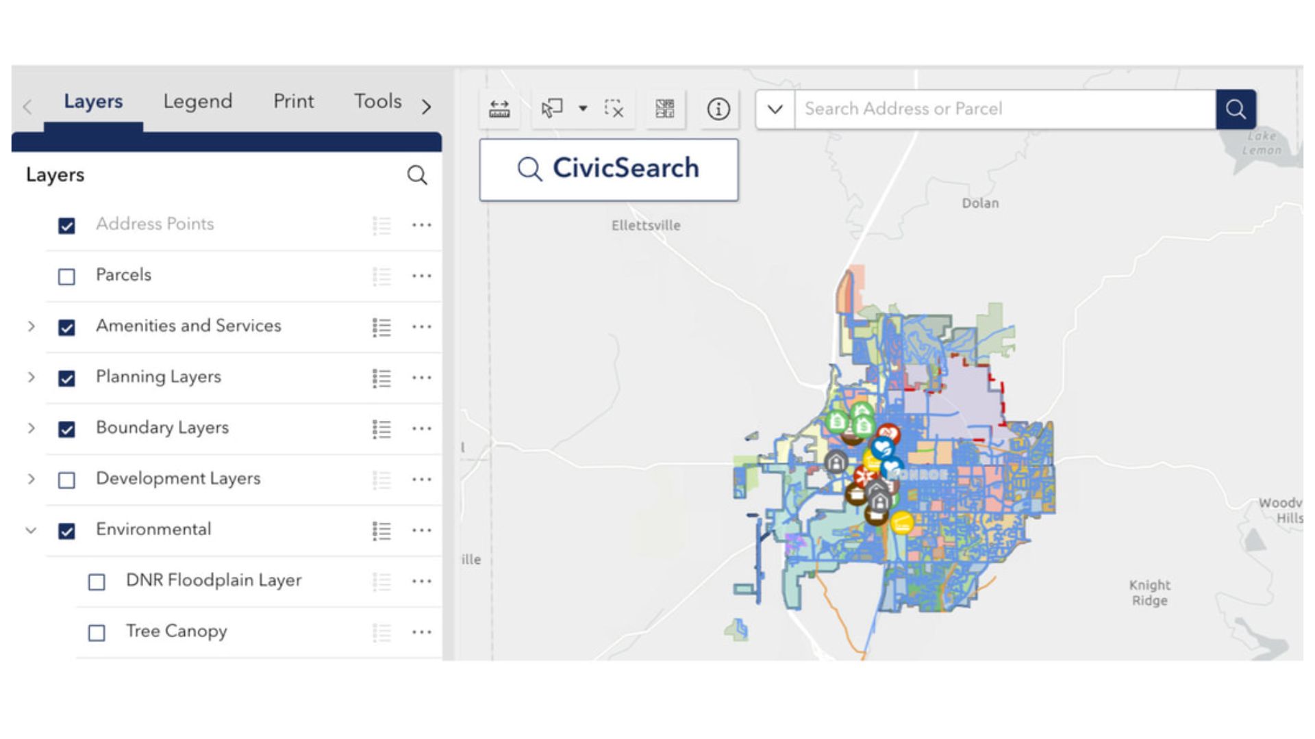
The map is designed to provide a comprehensive view of Bloomington’s resources, making it easier for people to explore their neighborhoods and discover local amenities. Users can view information ranging from parks and trails to public facilities, zoning and parcel details, neighborhood boundaries, school districts, voting precincts, floodplain areas, tree canopies, and even demographic data.
“The Community Map seeks to make information as easily accessible as possible,” said Meghan Blair, GIS Manager. “By having this data at their fingertips, residents have a new tool when deciding where to buy a home, open a business, or even just enjoy a leisurely park visit.”
A standout feature of the map is the CivicSearch address lookup, which allows users to type in any address and instantly see all relevant details for that location. From zoning designations to nearby amenities and neighborhood boundaries, the tool provides residents with an instant snapshot of their property and surrounding area. This functionality is particularly useful for those considering real estate decisions, opening new businesses, or simply exploring the city’s offerings.
The map also includes a dashboard feature that summarizes key metrics about Bloomington, providing users with a quick, comprehensive overview of the city. The dashboard highlights population statistics such as total population, median age, and housing characteristics, while also displaying community features like miles of trails and sidewalks. This addition helps users contextualize the interactive map with broader insights into the city’s infrastructure, resources, and demographics.
Behind the scenes, the Community Map is powered by the City’s Geographic Information Systems (GIS) program, which provides essential mapping and data services for multiple departments. By consolidating information in a single, accessible location, the map supports city planning, public works, and community development while offering residents a new way to interact with the city’s data.
City officials say the map was created with accessibility and simplicity in mind. With intuitive navigation and interactive layers, users can easily toggle between categories and explore the information most relevant to them. The tool is designed not only for tech-savvy residents but also for anyone who wants a clear and straightforward way to engage with local information.
The launch of the Bloomington Community Map reflects a growing trend among cities nationwide to use technology to enhance civic engagement and provide residents with instant access to vital information. By integrating mapping, demographic data, and community resources into one platform, Bloomington is offering residents a level of transparency and convenience that had previously required multiple sources or in-person inquiries.
As more residents explore the map, city officials hope it will become a go-to resource for a variety of needs—whether that’s finding a nearby park, checking school boundaries, reviewing zoning information, or learning more about the local environment. It also encourages residents to be more informed about city planning initiatives, infrastructure projects, and neighborhood characteristics.
The City of Bloomington’s ITS Department invites residents, business owners, and visitors to explore the new tool and see the wealth of information available at their fingertips. By providing this innovative platform, the city is not only increasing transparency but also empowering the community with knowledge that can guide decisions, spark engagement, and enhance the overall quality of life.
For those interested in exploring the Bloomington Community Map, it is now available online through the city’s website, offering an interactive experience that brings the city’s data directly to users.


